Filled Contour Mapping

Description

Generates a simple contour map from a file of space delimited XYZ data.
The methodology used is inverse distance weighting, with a smoothing parameter.
The model returns an image (raster) with a contour map overlay (as a JPG)


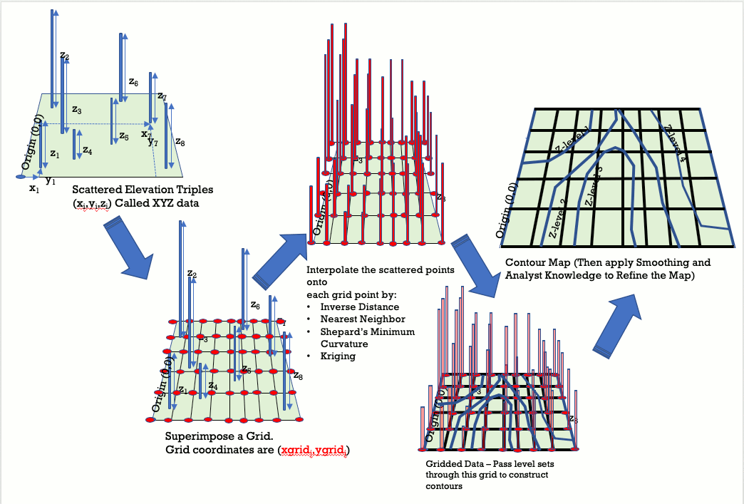
User supplies a file of XYZ data, and sets some gridding parameters.
The exponent is a value used in an inverse distance weighting,make it
large (~20) and algorithm approximates a nearest neighbor; make it small (~0.5)
and the map is smoothed a lot. The exponent must be larger than zero.

The smoothing parameter impacts the search distance -- larger values make
the map approach a mean value for all the supplied data. Smaller values keep
more weights on local values during gridding. 0 is an acceptable smoothing value.


Step 1: Generate an XYZ file, space (tab) delimited, on your computer.
Put it somewhere you can easily find the file for the upload step.


Step 2: Upload the XYZ file (Skip this step if the file is already uploaded)

Enter your username:

Enter your password:

Examine Existing Uploads


Step 3: Supply Gridding and Mapping Parameters Below

Gridding Parameters Mapping Parameters
Weighting Exponent: (1 to 3 are typical)

Map Title (Appears at Top of Map):

Smoothing Parameter:

Map Horizontal (X-Axis) Label :

Number of Output Grid Columns :

Map Vertical (Y-Axis) Label :

Number of Output Grid Rows :

XYZ Input File (must exist) :


Step 4: Build the Map


Return to Toolbox